Kategorie:Commons: Landkarte
Zur Navigation springen
Zur Suche springen
Medien in der Kategorie „Commons: Landkarte“
Folgende 116 Dateien sind in dieser Kategorie, von 116 insgesamt.
- 140px-Marktl.png 140 × 175; 14 KB
- 20040408124131!Ägypten.png 336 × 330; 6 KB
- 506px-California ref 2001.jpg 256 × 192; 24 KB
- Afghanistan-Pos.png 330 × 302; 20 KB
- Afrika-Bratwueste.png 411 × 401; 76 KB
- Afrika01.jpg 411 × 401; 15 KB
- AKWs Weltkarte.png 635 × 363; 130 KB
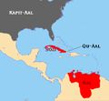
- Amerikaal.jpg 605 × 558; 26 KB
- Aralsee in Kamelform.jpg 455 × 341; 80 KB
- Atlantis map kircher.gif 839 × 581; 22 KB
- Ausbreitung.jpg 830 × 555; 83 KB
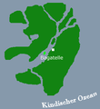
- Bagatelle.png 328 × 357; 6 KB
- Barbaria-Landkarte.jpg 1.320 × 564; 604 KB
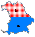
- Bayern Geteilt.png 334 × 351; 52 KB
- Bochum.JPG 524 × 358; 14 KB
- Bretagne map.png 200 × 189; 13 KB
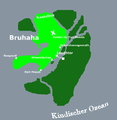
- Bruhaha.png 371 × 381; 14 KB
- China.png 600 × 400; 55 KB
- Deutschland aus saarlaendischer Sicht.svg 1.073 × 1.272; 556 KB
- Deutschland map.jpg 700 × 800; 107 KB
- Deutschland.png 351 × 377; 22 KB
- Deutschlands Ostkueste.png 351 × 378; 34 KB
- Dudenatoll Ausschnitt.png 750 × 475; 21 KB
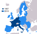
- EC1957-EU2007.gif 1.360 × 1.245; 28 KB
- Elfmeterbeinküste.png 330 × 354; 12 KB
- ElMehr.png 351 × 295; 8 KB
- Erdkuh.gif 432 × 249; 9 KB
- EU.png 764 × 600; 405 KB
- Europakamele.JPG 800 × 404; 49 KB
- Frankreich-Schweiz.png 1.200 × 761; 57 KB
- G-Länder.png 1.600 × 1.200; 293 KB
- Gallien.jpg 256 × 192; 17 KB
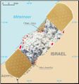
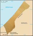
- Gaza Streifen3.jpg 471 × 506; 29 KB
- Gaza Strip.jpg 439 × 471; 19 KB
- Gedankenrohlinge.png 200 × 200; 3 KB
- Geograffiti.jpg 476 × 278; 45 KB
- Geograffiti.png 298 × 174; 112 KB
- Geopard.png 2.000 × 960; 157 KB
- Giftwolke.jpg 800 × 704; 87 KB
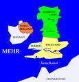
- Großbritannien3.JPG 916 × 959; 76 KB
- HaileyGail.png 371 × 381; 13 KB
- Herumtreiber.png 688 × 478; 40 KB
- HildesheimHauptgewinn.JPG 717 × 517; 26 KB
- Holstyn.png 737 × 600; 732 KB
- Irland.PNG 512 × 384; 4 KB
- Italien.jpg 600 × 800; 133 KB
- Kalau Nonpointe Ausschnitt.png 800 × 640; 33 KB
- Kalau-Diözesen.png 540 × 647; 49 KB
- Kalau.png 742 × 762; 39 KB
- Kalauische Eisenbahn.png 584 × 600; 172 KB
- KalauLuftschlösser.png 742 × 762; 62 KB
- Kamelonien.gif 880 × 646; 32 KB
- Kamelopedia Frankreich.JPG 304 × 385; 30 KB
- Kamelopedia Kroatien.JPG 327 × 356; 32 KB
- Kamäa.jpg 441 × 285; 11 KB
- Karte Kobe-Rind.jpg 470 × 300; 53 KB
- Karte Rumänien.png 800 × 600; 378 KB
- Karte-von-Hildesheim.gif 506 × 600; 417 KB
- Karte.jpg 420 × 300; 52 KB
- Karte.png 844 × 481; 55 KB
- Kartenausschnitt Mittelsee Südufer.jpg 1.024 × 768; 397 KB
- Kielce.jpg 800 × 513; 103 KB
- Kopp-Habitate.PNG 394 × 609; 11 KB
- Koreander Ausschnitt.png 860 × 920; 61 KB
- KushiWushi.Ausschnitt.jpg 768 × 784; 356 KB
- Landkarte.JPG 640 × 480; 310 KB
- LaPallje.png 332 × 360; 5 KB
- Lappland.jpg 518 × 492; 54 KB
- Lemakien.png 600 × 400; 18 KB
- Lidl-Aktivitäten.jpg 673 × 504; 62 KB
- Map of Kalau and Pandorra.png 2.500 × 2.000; 302 KB
- Marotte.png 618 × 664; 45 KB
- Mittelmeer.PNG 351 × 295; 11 KB
- Neu-jork-karte.jpg 484 × 347; 53 KB
- Nicht-Rügen.jpg 308 × 251; 28 KB
- Niedersachsen.jpg 1.191 × 666; 99 KB
- Ohne Kind Aber.jpg 632 × 360; 30 KB
- Operation Desert Storm.jpg 559 × 416; 60 KB
- Pan-Ama.jpg 256 × 192; 63 KB
- Paprikonien Karte.png 404 × 327; 92 KB
- Penisland Kopie.jpg 605 × 600; 156 KB
- Petitesse.png 371 × 381; 3 KB
- Petitesse2.png 371 × 381; 6 KB
- Pfuyi.png 400 × 640; 48 KB
- Pudelwohl.JPG 736 × 431; 28 KB
- Q-Land.png 432 × 366; 336 KB
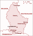
- Rosa Luxemburg.png 351 × 377; 31 KB
- Rote Karte.png 783 × 1.000; 347 KB
- Rudeshime.jpg 1.427 × 628; 177 KB
- S Amerika Eis.PNG 274 × 472; 5 KB
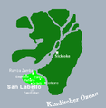
- SanLabello.png 371 × 381; 10 KB
- Schwarzwald.jpg 500 × 435; 23 KB
- Seekarte Kalau.png 584 × 600; 104 KB
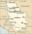
- Serbien.gif 328 × 352; 10 KB
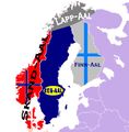
- Skandinavien-Aale.jpg 597 × 607; 44 KB
- Staatsform Deutschlands.jpg 640 × 480; 25 KB
- Stellenanzeige Geographie.jpg 302 × 223; 49 KB
- Stpölten.jpg 712 × 678; 106 KB
- Straße von Anian.jpg 256 × 192; 51 KB
- Stupid1.jpg 263 × 181; 13 KB
- Stöhnen.png 600 × 400; 14 KB
- Suedamerika-klein.jpg 425 × 550; 17 KB
- Swissmap.jpg 391 × 260; 51 KB
- Sylt.png 153 × 267; 3 KB
- Timbuktu.jpg 400 × 400; 39 KB
- Tohu Wabohu Ausschnitt.png 600 × 475; 24 KB
- Topflappen.GIF 674 × 444; 11 KB
- Ukraine.jpg 1.400 × 954; 134 KB
- Vulgarien Ausschnitt.PNG 210 × 105; 31 KB
- WB NetzEuropa.png 700 × 500; 267 KB
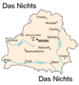
- Weissrussland-landkarte.png 330 × 355; 11 KB
- WießwurstÄquator.jpg 261 × 351; 22 KB
- Winnipeg by Myriem canadian english & johns'.PNG 503 × 292; 193 KB
- Woistkabul.JPG 570 × 423; 14 KB
- Zipangu map.png 350 × 446; 29 KB
- Ägypten.png 336 × 330; 6 KB

